
1975 Map of Wisconsin Dells South
USGS Topo · Published 1978About this map
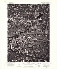
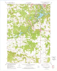
Wisconsin Dells and Lake Delton anchor this mid-1970s survey of the Wisconsin River corridor, where the landscape transitions from established resort communities to the conservation lands of Mirror Lake State Park. The area is defined by its complex hydrology, featuring the winding Wisconsin River and various water bodies like Mirror Lake and Lake of the Dells. Transportation infrastructure is prominent, with the Chicago Milwaukee St Paul and Pacific railroad cutting through the northeast and the Baraboo-Dells Airport situated to the south. Local heritage is preserved in numerous rural landmarks, including the Webster Prairie Cem and Spring Grove Cem, alongside distinct geological features like Hogsback Ridge and Rattlesnake Knob. The map also captures the recreational character of the era through several campgrounds and the Bell Creek State Wildlife Area.
Find a feature on this map
53 named features on this map. Tap any name to fly to it.
Don’t see what you’re looking for? This feature index may not catch every label — zoom into the map to look around manually.
Map Details
Editions of this 1975 Wisconsin Dells South Map
3 editions found
Other maps of this area

1895 · Baraboo
USGS Topo · 1:62,500

1901 · Denzer
USGS Topo · 1:62,500

1901 · The Dells
USGS Topo · 1:62,500

1902 · Briggsville
USGS Topo · 1:62,500

1908 · Baraboo
USGS Topo · 1:62,500

1957 · Wisconsin Dells
USGS Topo · 1:62,500

1957 · Madison
USGS Topo · 1:250,000

1958 · Briggsville
USGS Topo · 1:62,500

1958 · North Freedom
USGS Topo · 1:62,500

1959 · Baraboo
USGS Topo · 1:62,500