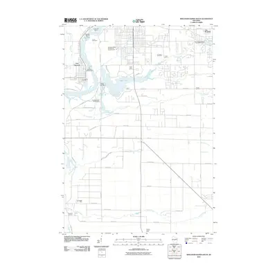
2010 Map of Wisconsin Rapids South
USGS Topo · Published 2010About this map
The Wisconsin River serves as the industrial and geographic anchor of this Wood County landscape, powering historical infrastructure like the Port Edwards 1874C276 Dam and the Centralia 1887C29 Dam. The settlement of Port Edwards is defined by its relationship to the water, with the Port Edwards Post Office and nearby Alexander Field South Wood County Airport serving as local hubs. This 2010 survey highlights a sophisticated network of water management and recreation, from the larger basins of Nepco Lake and Lake Wazeecha to the systematically named tributaries including Fourmile Creek, Fivemile Creek, and Tenmile Creek.
Find a feature on this map
56 named features on this map. Tap any name to fly to it.
Don’t see what you’re looking for? This feature index may not catch every label — zoom into the map to look around manually.
Map Details
Editions of this 2010 Wisconsin Rapids South Map
This is the sole edition of this map. No revisions or reprints were ever made.
Other maps of this area

1955 · Green Bay
USGS Topo · 1:250,000

1957 · Wisconsin Rapids
USGS Topo · 1:48,000

1957 · Whiting
USGS Topo · 1:48,000

1958 · Arkdale
USGS Topo · 1:48,000

1958 · Coloma
USGS Topo · 1:48,000

1967 · Arkdale NE
USGS Topo · 1:24,000

1967 · Wisconsin Rapids
USGS Topo · 1:62,500

1968 · Coloma NW
USGS Topo · 1:24,000
1969 · Arkdale NW
USGS Topo · 1:24,000

1970 · Kellner
USGS Topo · 1:24,000