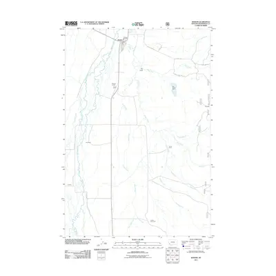
2011 Map of Wisdom
USGS Topo · Published 2011About this map
The Wisdom settlement serves as the primary hub in this corner of Beaverhead County, characterized by a network of ranching properties and high-altitude water systems. The landscape is defined by the winding course of the Big Hole River and its numerous tributaries, including Stanley Creek and Sheep Creek. The layout of the town is remarkably legible, showing essential civic infrastructure such as the Wisdom Post Office, Wisdom Fire Dept, and the Wisdom Airport. Outside the town center, the map documents a series of named ranch holdings such as Clapp Ranch, M Clemow, and Huntley Home Ranch, illustrating the legacy of land ownership in the region. Further east, the Clara Mine and the Dry Fields Dam represent the industrial and agricultural modifications made to this mountain valley, while the presence of Dry Gulch and Hooligan Creek highlights the complex local drainage patterns that dictated the placement of early roads like Steer Creek Rd.
Find a feature on this map
30 named features on this map. Tap any name to fly to it.
Don’t see what you’re looking for? This feature index may not catch every label — zoom into the map to look around manually.
Map Details
Editions of this 2011 Wisdom Map
This is the sole edition of this map. No revisions or reprints were ever made.
Other maps of this area

1955 · Dillon
USGS Topo · 1:250,000

1957 · Dillon
USGS Topo · 1:250,000

1958 · Dillon
USGS Topo · 1:250,000

1962 · Dillon
USGS Topo · 1:250,000

1962 · Wisdom
USGS Topo · 1:24,000

1962 · Mud Lake
USGS Topo · 1:24,000

1962 · Stewart Mountain
USGS Topo · 1:24,000

1962 · Proposal Rock
USGS Topo · 1:24,000

1965 · Dillon
USGS Topo · 1:250,000

1966 · Gibbons School
USGS Topo · 1:24,000