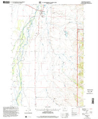
1997 Map of Wisdom
USGS Topo · Published 2002About this map
Wisdom serves as the focal point of this Big Hole Valley landscape, situated where the Lewis and Clark National Historic Trail intersects the Big Hole River drainage. The map documents a ranching-heavy settlement pattern in the late 20th century, with family-named properties like Clapp Ranch, Francis Ranch, and the Huntley Home Ranch defining the valley floor. To the east, the terrain rises into the Beaverhead National Forest, where the Clara Mine and several gulches suggest the area's mineral prospects.
Find a feature on this map
26 named features on this map. Tap any name to fly to it.
Don’t see what you’re looking for? This feature index may not catch every label — zoom into the map to look around manually.
Map Details
Editions of this 1997 Wisdom Map
This is the sole edition of this map. No revisions or reprints were ever made.
Other maps of this area

1955 · Dillon
USGS Topo · 1:250,000

1957 · Dillon
USGS Topo · 1:250,000

1958 · Dillon
USGS Topo · 1:250,000

1962 · Dillon
USGS Topo · 1:250,000

1962 · Wisdom
USGS Topo · 1:24,000

1962 · Mud Lake
USGS Topo · 1:24,000

1962 · Stewart Mountain
USGS Topo · 1:24,000

1962 · Proposal Rock
USGS Topo · 1:24,000

1965 · Dillon
USGS Topo · 1:250,000

1966 · Gibbons School
USGS Topo · 1:24,000