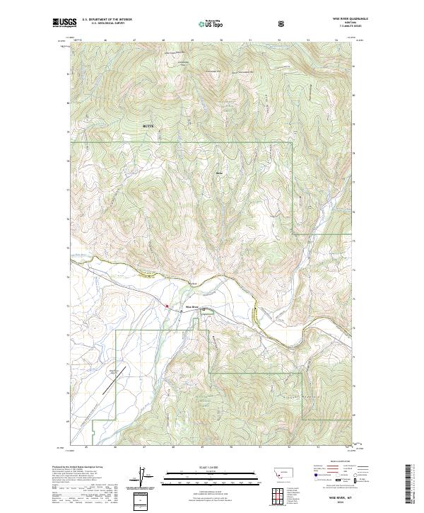
2024 Map of Wise River
USGS Topo · Published 2024About this map
Wise River sits at the northern edge of the Pioneer Mountains where the river of the same name joins the Big Hole River. This high-altitude landscape is characterized by steep ridges like Bean Ridge and Burnt Dam Ridge, with several peaks such as Grassy Granulated Mtn rising above the timberline. The area is dominated by the Beaverhead National Forest, reflecting a geography shaped by conservation and mountain recreation.
Find a feature on this map
51 named features on this map. Tap any name to fly to it.
Don’t see what you’re looking for? This feature index may not catch every label — zoom into the map to look around manually.
Map Details
Editions of this 2024 Wise River Map
This is the sole edition of this map. No revisions or reprints were ever made.
Other maps of this area

1893 · Dillon
USGS Topo · 1:250,000

1955 · Dillon
USGS Topo · 1:250,000

1957 · Dillon
USGS Topo · 1:250,000

1958 · Dillon
USGS Topo · 1:250,000

1958 · Vipond Park
USGS Topo · 1:62,500
1961 · Burnt Mountain
USGS Topo · 1:24,000
1961 · Dickie Peak
USGS Topo · 1:24,000

1961 · Dewey
USGS Topo · 1:24,000

1961 · Wise River
USGS Topo · 1:24,000

1962 · Dillon
USGS Topo · 1:250,000