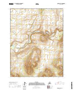
2017 Map of Wiseman A-2 SE
USGS Topo · Published 2017About this map
Gates of the Arctic National Park encompasses a significant portion of this interior Alaskan landscape, where the meandering course of the Middle Fork Koyukuk River dominates the central topography. This 2017 survey illustrates the remote wilderness character of the Yukon-Koyukuk region, defined by steep contour intervals and the hydrological network of the Brooks Range foothills. The river's path is fed by local tributaries including John R Cr and Smally Cr, which drain the surrounding highlands. This map is a vital resource for understanding the contemporary boundaries and natural features of one of the most northern protected wilderness areas in the United States, providing precise data on the drainage patterns and elevation changes across several townships and ranges.
Find a feature on this map
13 named features on this map. Tap any name to fly to it.
Don’t see what you’re looking for? This feature index may not catch every label — zoom into the map to look around manually.
Map Details
Editions of this 2017 Wiseman A-2 SE Map
This is the sole edition of this map. No revisions or reprints were ever made.
Other maps of this area

1951 · Bettles
USGS Topo · 1:250,000

1951 · Wiseman
USGS Topo · 1:250,000

1956 · Bettles
USGS Topo · 1:250,000

1956 · Wiseman
USGS Topo · 1:250,000

1964 · Wiseman
USGS Topo · 1:250,000

1970 · Wiseman A-1
USGS Topo · 1:63,360
1970 · Bettles D-1
USGS Topo · 1:63,360

1970 · Wiseman A-2
USGS Topo · 1:63,360

1970 · Bettles D-2
USGS Topo · 1:63,360
2017 · Wiseman A-2 NE
USGS Topo · 1:25,000