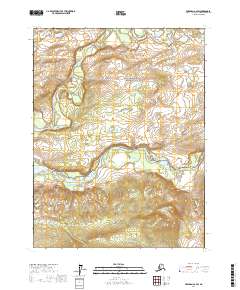
2017 Map of Wiseman A-2 SW
USGS Topo · Published 2017About this map
Gates Of The Arctic National Park encompasses the northern portion of this landscape, where the North Fork Koyukuk River winds through the interior before it eventually meets the Middle Fork Koyukuk River to the south. The terrain is characterized by the prominent elevations of the Jack White Range, which rises above the river valleys. This 2017 survey documents a wilderness largely defined by its drainage systems, including Florence Cr in the northwest corner. The absence of roads or permanent structures reflects the preserved status of this subarctic environment, emphasizing the natural corridors formed by the braided river channels that have historically guided travel through the Yukon-Koyukuk region.
Find a feature on this map
12 named features on this map. Tap any name to fly to it.
Don’t see what you’re looking for? This feature index may not catch every label — zoom into the map to look around manually.
Map Details
Editions of this 2017 Wiseman A-2 SW Map
This is the sole edition of this map. No revisions or reprints were ever made.
Other maps of this area

1951 · Bettles
USGS Topo · 1:250,000

1951 · Wiseman
USGS Topo · 1:250,000

1956 · Bettles
USGS Topo · 1:250,000

1956 · Wiseman
USGS Topo · 1:250,000

1964 · Wiseman
USGS Topo · 1:250,000

1970 · Wiseman A-3
USGS Topo · 1:63,360

1970 · Wiseman A-2
USGS Topo · 1:63,360

1970 · Bettles D-3
USGS Topo · 1:63,360

1970 · Bettles D-2
USGS Topo · 1:63,360
2016 · Wiseman A-3 NE
USGS Topo · 1:25,000