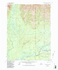
1970 Map of Wiseman A-3
USGS Topo · Published 1987About this map
Gates of the Arctic National Park encompasses the eastern portion of this 1970 landscape, where the Park Boundary bisects a terrain of high ridges and winding waterways. The Koyukuk River dominates the southern reaches, joined by the Middle Fork and North Fork near a complex network of seasonal channels. Remote outposts like Chicken and a lone Cabin are connected by a traditional Winter Trail, reflecting the survivalist infrastructure of the Brooks Range before major modern developments.
Find a feature on this map
18 named features on this map. Tap any name to fly to it.
Don’t see what you’re looking for? This feature index may not catch every label — zoom into the map to look around manually.
Map Details
Editions of this 1970 Wiseman A-3 Map
2 editions found
Other maps of this area

1951 · Bettles
USGS Topo · 1:250,000

1951 · Wiseman
USGS Topo · 1:250,000

1956 · Bettles
USGS Topo · 1:250,000

1956 · Wiseman
USGS Topo · 1:250,000

1964 · Wiseman
USGS Topo · 1:250,000

1970 · Bettles D-4
USGS Topo · 1:63,360

1970 · Wiseman A-4
USGS Topo · 1:63,360

1970 · Wiseman A-3
USGS Topo · 1:63,360

1970 · Wiseman A-2
USGS Topo · 1:63,360

1970 · Bettles D-3
USGS Topo · 1:63,360