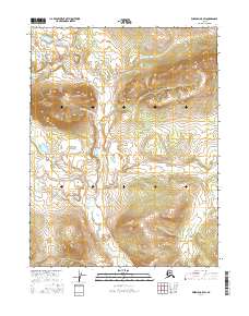
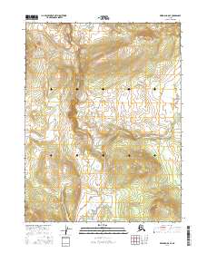
2016 Map of Wiseman A-5 SW
USGS Topo · Published 2016About this map
Heart Mountain and the southern slopes of the Alatna Hills define this expanse of the Yukon-Koyukuk region, mapped here in detail by the U.S. Geological Survey. The landscape is etched by several prominent watercourses, most notably the East Fork Henshaw Creek and the smaller Bedrock Creek. This 2016 survey documents a largely roadless interior, emphasizing the natural topography and hydrologic patterns of the Alaskan wilderness. The survey data incorporates imagery from SPOT and elevation models, providing a precise record of the terrain for modern researchers and geographers studying this remote portion of the state.
Find a feature on this map
10 named features on this map. Tap any name to fly to it.
Don’t see what you’re looking for? This feature index may not catch every label — zoom into the map to look around manually.
Map Details
Editions of this 2016 Wiseman A-5 SW Map
This is the sole edition of this map. No revisions or reprints were ever made.
Other maps of this area

1951 · Bettles
USGS Topo · 1:250,000

1951 · Wiseman
USGS Topo · 1:250,000

1956 · Bettles
USGS Topo · 1:250,000

1956 · Wiseman
USGS Topo · 1:250,000

1964 · Wiseman
USGS Topo · 1:250,000
1970 · Wiseman A-6
USGS Topo · 1:63,360
1970 · Bettles D-6
USGS Topo · 1:63,360

1970 · Wiseman A-5
USGS Topo · 1:63,360
1970 · Bettles D-5
USGS Topo · 1:63,360
2016 · Wiseman A-5 SE
USGS Topo · 1:25,000