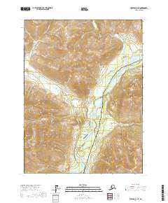
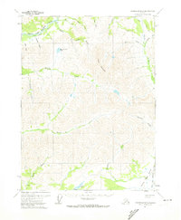
2017 Map of Wiseman B-1 NE
USGS Topo · Published 2017About this map
Wiseman remains a focal point of this northern interior landscape, situated along the Middle Fork Koyukuk River. The settlement is supported by the Wiseman Airport and the Wiseman/Nolan Road, which connects the community to surrounding gold-bearing drainages. The corridor is dominated by modern infrastructure, specifically the Dalton Highway and the Alaska Pipeline, which cut north-south through the valley. Significant relief is documented by numerous summits including Midnight Dome, Smith Creek Dome, and Gobblers Knob. The geography is defined by a dense network of gulches and creeks, such as Gold Bottom Gulch and Confederate Gulch, which feed into major waterways like the Hammond River. This 2017 survey illustrates the persistent intersection of historic mining-era access roads with the large-scale energy transport systems of the modern Brooks Range frontier.
Find a feature on this map
37 named features on this map. Tap any name to fly to it.
Don’t see what you’re looking for? This feature index may not catch every label — zoom into the map to look around manually.
Map Details
Editions of this 2017 Wiseman B-1 NE Map
This is the sole edition of this map. No revisions or reprints were ever made.
Other maps of this area

1951 · Chandalar
USGS Topo · 1:250,000

1951 · Wiseman
USGS Topo · 1:250,000

1956 · Chandalar
USGS Topo · 1:250,000

1956 · Wiseman
USGS Topo · 1:250,000

1964 · Wiseman
USGS Topo · 1:250,000

1964 · Chandalar
USGS Topo · 1:250,000
1971 · Chandalar C-6
USGS Topo · 1:63,360
1971 · Wiseman C-1
USGS Topo · 1:63,360
1971 · Wiseman B-1
USGS Topo · 1:63,360
1971 · Chandalar B-6
USGS Topo · 1:63,360