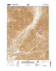
2016 Map of Wiseman B-4 NW
USGS Topo · Published 2016About this map
Allen River dominates this portion of the Yukon-Koyukuk region, winding through a complex drainage basin defined by steep topographic gradients. The landscape is characterized by the confluence of mountain-sourced tributaries, including McCamant Cr and Bar Cr, which feed into the primary river system. This 2016 survey illustrates the remote wilderness character of the Alaska interior, where the lack of human infrastructure or roads highlights the raw, natural geography of the Brooks Range foothills. Boundary lines for t31n r20w and t30n r19w provide the only formal structure across a terrain shaped almost entirely by hydrological forces and elevation changes. Geographers and naturalists can trace the intricate stream patterns and ridge lines that define this uninhabited territory.
Find a feature on this map
7 named features on this map. Tap any name to fly to it.
Don’t see what you’re looking for? This feature index may not catch every label — zoom into the map to look around manually.
Map Details
Editions of this 2016 Wiseman B-4 NW Map
This is the sole edition of this map. No revisions or reprints were ever made.
Other maps of this area

1951 · Wiseman
USGS Topo · 1:250,000

1956 · Wiseman
USGS Topo · 1:250,000

1964 · Wiseman
USGS Topo · 1:250,000

1971 · Wiseman C-4
USGS Topo · 1:63,360

1971 · Wiseman C-5
USGS Topo · 1:63,360
1971 · Wiseman B-5
USGS Topo · 1:63,360
1971 · Wiseman B-4
USGS Topo · 1:63,360
2016 · Wiseman B-4 SE
USGS Topo · 1:25,000
2016 · Wiseman B-4 SW
USGS Topo · 1:25,000
2016 · Wiseman C-4 SW
USGS Topo · 1:25,000