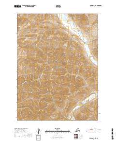
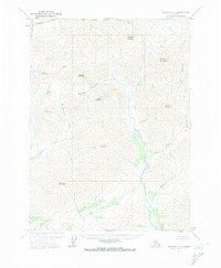
2017 Map of Wiseman C-1 NE
USGS Topo · Published 2017About this map
Gates of the Arctic National Park encompasses the vast majority of this wilderness landscape, showcasing the complex topography of the Brooks Range. The Hammond River winds through the eastern portion of the quadrangle, serving as a primary drainage for the surrounding highlands. Notable summits and ridges such as Jesse Mtn rise above narrow valleys carved by local waterways. These drainage systems, including Sleepy Cr, King Cr, and Jesse Cr, illustrate the intricate natural watershed patterns of the Yukon-Koyukuk region. This survey provides a precise look at the land's contours and river courses as they existed in the early twenty-first century, before any modern development or infrastructure altered these protected lands.
Find a feature on this map
12 named features on this map. Tap any name to fly to it.
Don’t see what you’re looking for? This feature index may not catch every label — zoom into the map to look around manually.
Map Details
Editions of this 2017 Wiseman C-1 NE Map
This is the sole edition of this map. No revisions or reprints were ever made.
Other maps of this area

1951 · Chandalar
USGS Topo · 1:250,000

1951 · Wiseman
USGS Topo · 1:250,000

1956 · Chandalar
USGS Topo · 1:250,000

1956 · Wiseman
USGS Topo · 1:250,000

1964 · Wiseman
USGS Topo · 1:250,000

1964 · Chandalar
USGS Topo · 1:250,000
1971 · Chandalar D-6
USGS Topo · 1:63,360
1971 · Chandalar C-6
USGS Topo · 1:63,360
1971 · Wiseman C-1
USGS Topo · 1:63,360
1971 · Wiseman D-1
USGS Topo · 1:63,360