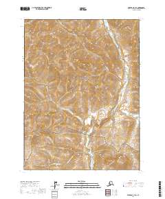
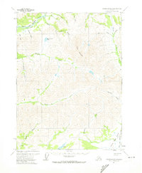
2017 Map of Wiseman C-1 SE
USGS Topo · Published 2017About this map
Gates Of The Arctic National Park encompasses much of this 2017 survey area, where the high-latitude drainage systems of the Hammond River and its tributaries carve through the Brooks Range. The landscape is defined by massive peaks like Grotto Mtn and Vermont Dome, connected by the natural corridor of Vermont Pass. This region is a study in Arctic hydrology, featuring seasonal watercourses such as Grotto Cr and Canyon Cr, alongside the isolated Jennie Cr Lake. Gold-mining history is whispered through the naming of several narrow drainages, including Montana Gulch and Sunrise Gulch, which join the larger flow of Vermont Cr and Nolan Cr. The topographic detail illustrates the sharp elevation changes between the river basin and the high ridgelines of Dusty Mtn, capturing a pristine wilderness area in the Yukon-Koyukuk region.
Find a feature on this map
19 named features on this map. Tap any name to fly to it.
Don’t see what you’re looking for? This feature index may not catch every label — zoom into the map to look around manually.
Map Details
Editions of this 2017 Wiseman C-1 SE Map
This is the sole edition of this map. No revisions or reprints were ever made.
Other maps of this area

1951 · Chandalar
USGS Topo · 1:250,000

1951 · Wiseman
USGS Topo · 1:250,000

1956 · Chandalar
USGS Topo · 1:250,000

1956 · Wiseman
USGS Topo · 1:250,000

1964 · Wiseman
USGS Topo · 1:250,000

1964 · Chandalar
USGS Topo · 1:250,000
1971 · Chandalar C-6
USGS Topo · 1:63,360
1971 · Wiseman C-1
USGS Topo · 1:63,360
1971 · Wiseman B-1
USGS Topo · 1:63,360
1971 · Chandalar B-6
USGS Topo · 1:63,360