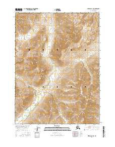
2016 Map of Wiseman C-4 NE
USGS Topo · Published 2016About this map
Gates Of The Arctic National Park encompasses the entirety of this interior Alaskan landscape, which remains largely untouched by modern infrastructure. The terrain is defined by the drainage of Swamp Cr, which flows southward through the center of the sheet towards the Allen River in the southwestern corner. In the southeastern quadrant, Tobin Mtn provides a significant vertical landmark amidst a complex series of ridges and valleys. This 2016 survey illustrates the pristine wilderness character of the Yukon-Koyukuk region, where the primary organizational structure is the Public Land Survey System rather than roads or settlements. The map provides a high-resolution view of the natural hydrology and contouring that defines one of the most remote protected areas in the United States.
Find a feature on this map
12 named features on this map. Tap any name to fly to it.
Don’t see what you’re looking for? This feature index may not catch every label — zoom into the map to look around manually.
Map Details
Editions of this 2016 Wiseman C-4 NE Map
This is the sole edition of this map. No revisions or reprints were ever made.
Other maps of this area

1951 · Wiseman
USGS Topo · 1:250,000

1956 · Wiseman
USGS Topo · 1:250,000

1964 · Wiseman
USGS Topo · 1:250,000

1971 · Wiseman C-4
USGS Topo · 1:63,360
1971 · Wiseman D-4
USGS Topo · 1:63,360
1971 · Wiseman D-3
USGS Topo · 1:63,360
1971 · Wiseman C-3
USGS Topo · 1:63,360
2016 · Wiseman C-4 SW
USGS Topo · 1:25,000
2016 · Wiseman C-4 SE
USGS Topo · 1:25,000
2016 · Wiseman C-3 NW
USGS Topo · 1:25,000