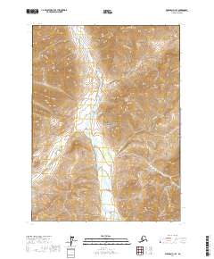
2017 Map of Wiseman D-1 SE
USGS Topo · Published 2017About this map
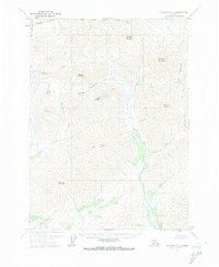
Gates Of The Arctic National Park dominates the interior of this 2017 survey, representing a strictly protected wilderness within the Yukon-Koyukuk region. The landscape is defined by the substantial drainage system of the Hammond River, which flows southward through the center of the quadrangle. Steep, high-elevation terrain is carved by numerous tributaries including Kupuk Cr and Kapoon Cr to the east, while Roy Cr and Eekayruk Cr feed the river from the west. The lack of any roads or established settlements on the sheet underscores the area's isolation and the USGS's focus on mapping the precise hydrography and topography of the Brooks Range foothills.
Find a feature on this map
10 named features on this map. Tap any name to fly to it.
Don’t see what you’re looking for? This feature index may not catch every label — zoom into the map to look around manually.
Map Details
Editions of this 2017 Wiseman D-1 SE Map
This is the sole edition of this map. No revisions or reprints were ever made.
Other maps of this area

1951 · Chandalar
USGS Topo · 1:250,000

1951 · Wiseman
USGS Topo · 1:250,000

1956 · Chandalar
USGS Topo · 1:250,000

1956 · Wiseman
USGS Topo · 1:250,000

1964 · Wiseman
USGS Topo · 1:250,000

1964 · Chandalar
USGS Topo · 1:250,000
1971 · Chandalar D-6
USGS Topo · 1:63,360
1971 · Chandalar C-6
USGS Topo · 1:63,360
1971 · Wiseman C-1
USGS Topo · 1:63,360
1971 · Wiseman D-1
USGS Topo · 1:63,360