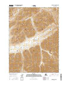
2016 Map of Wiseman D-3 SE
USGS Topo · Published 2016About this map
Gates Of The Arctic National Park encompasses the central portion of this 2016 survey, representing a landscape where high-altitude relief and glacial drainages dictate the geography. The map captures the Brooks Range environment at a moment when its wilderness character is preserved within federal protections, showing a terrain defined by steep contour intervals and seasonal waterways. Several distinct creek systems originate in these highlands, including the northeast-flowing Fish Cr and the westward-trending Kachwona Cr. In the southern half of the sheet, Cladonia Cr winds through the deep valleys between unnamed peaks, illustrating the complex hydrology of the Yukon-Koyukuk region. This cartography focuses on the physical environment, detailing the intricate relationship between elevation and drainage patterns in a territory devoid of permanent roads or structures.
Find a feature on this map
8 named features on this map. Tap any name to fly to it.
Don’t see what you’re looking for? This feature index may not catch every label — zoom into the map to look around manually.
Map Details
Editions of this 2016 Wiseman D-3 SE Map
This is the sole edition of this map. No revisions or reprints were ever made.
Other maps of this area

1951 · Wiseman
USGS Topo · 1:250,000

1956 · Wiseman
USGS Topo · 1:250,000

1964 · Wiseman
USGS Topo · 1:250,000

1971 · Wiseman C-2
USGS Topo · 1:63,360
1971 · Wiseman D-2
USGS Topo · 1:63,360
1971 · Wiseman D-3
USGS Topo · 1:63,360
1971 · Wiseman C-3
USGS Topo · 1:63,360
2016 · Wiseman C-3 NE
USGS Topo · 1:25,000
2016 · Wiseman C-3 NW
USGS Topo · 1:25,000
2016 · Wiseman D-3 SW
USGS Topo · 1:25,000