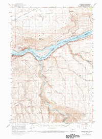
1957 Map of Wishram
USGS Topo · Published 1967About this map
The Columbia River Lake Celilo dominates this 1957 landscape, serving as the border between Washington and Oregon during a decade of significant river engineering. The rail network is particularly dense here, featuring the S P & S and the Union Pacific tracing the riverbanks, while the Oregon Trunk Ry crosses the water. Along the northern bluffs, the Stonehenge Memorial and Maryhill Museum stand as cultural landmarks near the settlement of Maryhill.
Find a feature on this map
40 named features on this map. Tap any name to fly to it.
Don’t see what you’re looking for? This feature index may not catch every label — zoom into the map to look around manually.
Map Details
Editions of this 1957 Wishram Map
2 editions found

Other maps of this area

1930 · Dufur
USGS Topo · 1:125,000

1934 · Dufur
USGS Topo · 1:125,000

1934 · The Dalles
USGS Topo · 1:125,000

1953 · The Dalles
USGS Topo · 1:250,000

1956 · The Dalles
USGS Topo · 1:250,000

1957 · The Dalles
USGS Topo · 1:250,000

1957 · Wasco
USGS Topo · 1:62,500

1957 · Klickitat
USGS Topo · 1:62,500

1957 · Goldendale
USGS Topo · 1:62,500

1957 · The Dalles
USGS Topo · 1:62,500