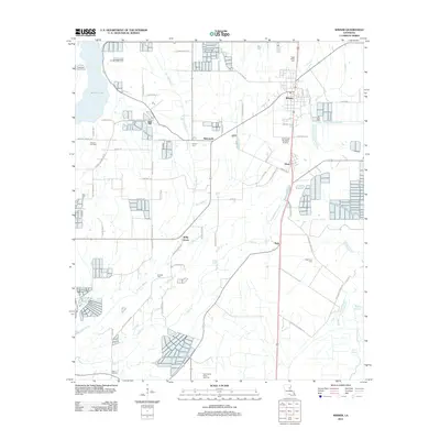
2012 Map of Wisner
USGS Topo · Published 2012About this map
The town of Wisner serves as the primary hub in this corner of Franklin Parish, where the local economy transitions between established agriculture and energy extraction. The landscape is defined by an intricate network of drainage ways, including Brushey Bayou, Black Bayou, and Loften Bayou, which navigate the low-lying terrain. For those researching local families, the map identifies several burial grounds such as Hope Estate Cem, Humble Cem, and New Zion Cem, often associated with smaller rural clusters like Metropolis and Holly Grove. Industrial activity is evident through the Wisner Oil Field and the North Sicily Island Gas Field in the south, while the Yarbrough Brothers Airstrip points to the importance of aerial access in this rural region. The grid of parish roads, many named for local families like Barton Rd and R Campbell Rd, provides a clear view of land division and residency patterns in the early 21st century.
Find a feature on this map
57 named features on this map. Tap any name to fly to it.
Don’t see what you’re looking for? This feature index may not catch every label — zoom into the map to look around manually.
Map Details
Editions of this 2012 Wisner Map
This is the sole edition of this map. No revisions or reprints were ever made.
Other maps of this area

1935 · Winnsboro
USGS Topo · 1:62,500

1939 · Fort Necessity
USGS Topo · 1:62,500

1941 · Sicily Island
USGS Topo · 1:62,500

1941 · Harrisonburg
USGS Topo · 1:62,500

1953 · Natchez
USGS Topo · 1:250,000

1955 · Jackson
USGS Topo · 1:250,000

1956 · Natchez
USGS Topo · 1:250,000

1957 · Sicily Island
USGS Topo · 1:62,500

1958 · Winnsboro
USGS Topo · 1:62,500

1958 · Fort Necessity
USGS Topo · 1:62,500