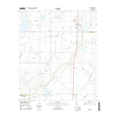
2015 Map of Wisner
USGS Topo · Published 2015About this map
The town of Wisner serves as the focal point for this survey of the lowlands where Franklin Parish meets Catahoula Parish. The landscape is defined by an intricate network of drainage ways, including Brushey Bayou, Loften Bayou, and Black Bayou, which weave through the agricultural flats. Several small communities and named locations like Metropolis, Elam, Holly Grove, and Peck are situated along the primary thoroughfares, such as La-876 and La-562. Genealogists will find a cluster of burial sites across the region, including Hope Estate Cem, Central Cem, New Zion Cem, and Humble Cem. The eastern portion of the map is dominated by the course of Deer Creek and its associated Deer Creek Cutoff, illustrating the complex water management required in this delta-adjacent environment. To the northwest, Turkey Creek Lake provides a significant water feature amidst the grid of rural roads and section lines.
Find a feature on this map
80 named features on this map. Tap any name to fly to it.
Don’t see what you’re looking for? This feature index may not catch every label — zoom into the map to look around manually.
Map Details
Editions of this 2015 Wisner Map
This is the sole edition of this map. No revisions or reprints were ever made.
Other maps of this area

1935 · Winnsboro
USGS Topo · 1:62,500

1939 · Fort Necessity
USGS Topo · 1:62,500

1941 · Sicily Island
USGS Topo · 1:62,500

1941 · Harrisonburg
USGS Topo · 1:62,500

1953 · Natchez
USGS Topo · 1:250,000

1955 · Jackson
USGS Topo · 1:250,000

1956 · Natchez
USGS Topo · 1:250,000

1957 · Sicily Island
USGS Topo · 1:62,500

1958 · Winnsboro
USGS Topo · 1:62,500

1958 · Fort Necessity
USGS Topo · 1:62,500