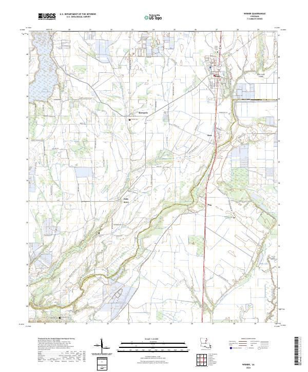
2024 Map of Wisner
USGS Topo · Published 2024About this map
Wisner serves as the primary hub in this agricultural region of Franklin Parish, where a grid of rural roads connects several small settlements and community landmarks. The landscape is defined by its complex hydrology, with Turkey Creek Lake in the northwest and a network of winding waterways like Brushey Bayou, Black Bayou, and Deer Creek that meander across the terrain. These watercourses historically shaped the boundaries and accessibility of local farms and homesteads. Local history is anchored by numerous burial grounds distributed throughout the landscape, including Hope Estate Cem near the town center and more remote sites such as Humble Cem and New Zion Cem. The transition into Catahoula Parish in the southern portion of the map is marked by the presence of Bayou Falcon and Boggy Bayou, illustrating the dense alluvial nature of the Louisiana delta.
Find a feature on this map
71 named features on this map. Tap any name to fly to it.
Don’t see what you’re looking for? This feature index may not catch every label — zoom into the map to look around manually.
Map Details
Editions of this 2024 Wisner Map
This is the sole edition of this map. No revisions or reprints were ever made.
Other maps of this area

1935 · Winnsboro
USGS Topo · 1:62,500

1939 · Fort Necessity
USGS Topo · 1:62,500

1941 · Sicily Island
USGS Topo · 1:62,500

1941 · Harrisonburg
USGS Topo · 1:62,500

1953 · Natchez
USGS Topo · 1:250,000

1955 · Jackson
USGS Topo · 1:250,000

1956 · Natchez
USGS Topo · 1:250,000

1957 · Sicily Island
USGS Topo · 1:62,500

1958 · Winnsboro
USGS Topo · 1:62,500

1958 · Fort Necessity
USGS Topo · 1:62,500