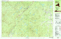
1978 Map of Witherbee
USGS Topo · Published 1979About this map
Mineville and Witherbee serve as the primary residential hubs in this high-altitude landscape of the eastern Adirondacks. The 1970s infrastructure highlights the region's industrial foundations, specifically the Lake Champlain and Moriah Railroad which winds through the complex topography to serve the mining settlements. While much of the area is designated as Adirondack Park, the concentration of development in Grover Hills and Moriah Center shows the persistence of mountain communities.
Find a feature on this map
119 named features on this map. Tap any name to fly to it.
Don’t see what you’re looking for? This feature index may not catch every label — zoom into the map to look around manually.
Map Details
Editions of this 1978 Witherbee Map
This is the sole edition of this map. No revisions or reprints were ever made.
Other maps of this area

1894 · Elizabethtown
USGS Topo · 1:62,500

1894 · Port Henry
USGS Topo · 1:62,500

1894 · Ticonderoga
USGS Topo · 1:62,500

1895 · Elizabethtown
USGS Topo · 1:62,500

1895 · Mt. Marcy
USGS Topo · 1:62,500

1895 · Paradox Lake
USGS Topo · 1:62,500

1896 · Ticonderoga
USGS Topo · 1:62,500

1897 · Paradox Lake
USGS Topo · 1:62,500

1897 · Schroon Lake
USGS Topo · 1:62,500

1898 · Port Henry
USGS Topo · 1:62,500