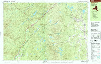
1999 Map of Witherbee
USGS Topo · Published 2000About this map
Adirondack Park dominates this late-century landscape, characterized by the dense topography of the Eastern Adirondacks where the legacy of iron mining remains visible. The industrial core is centered on Witherbee and Mineville, where the Lake Champlain and Moriah Railroad corridor cuts through the hills to serve these historically significant mining settlements. To the south, the community of Moriah Center and Moriah provide a more residential character, anchored by local institutions like St Joseph the Worker Sch and the SS Peter and Paul Cem.
Find a feature on this map
115 named features on this map. Tap any name to fly to it.
Don’t see what you’re looking for? This feature index may not catch every label — zoom into the map to look around manually.
Map Details
Editions of this 1999 Witherbee Map
This is the sole edition of this map. No revisions or reprints were ever made.
Other maps of this area

1894 · Elizabethtown
USGS Topo · 1:62,500

1894 · Port Henry
USGS Topo · 1:62,500

1894 · Ticonderoga
USGS Topo · 1:62,500

1895 · Elizabethtown
USGS Topo · 1:62,500

1895 · Mt. Marcy
USGS Topo · 1:62,500

1895 · Paradox Lake
USGS Topo · 1:62,500

1896 · Ticonderoga
USGS Topo · 1:62,500

1897 · Paradox Lake
USGS Topo · 1:62,500

1897 · Schroon Lake
USGS Topo · 1:62,500

1898 · Port Henry
USGS Topo · 1:62,500