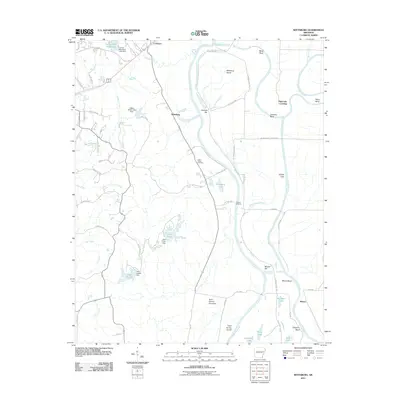
2011 Map of Wittsburg
USGS Topo · Published 2011About this map
Wittsburg and Levesque occupy a landscape defined by the shifting course of the Saint-Francis River and its accompanying flood control infrastructure. The river's meanders create distinct features like Wittsburg Island, Johnson Bend, and Mussel Bar, while the Saint Francis Floodway and St Francis Levee Rd reveal the managed nature of this alluvial terrain. To the west, the topography rises away from the bottomlands, marked by a network of creeks such as Cane Creek and Crow Creek.
Find a feature on this map
74 named features on this map. Tap any name to fly to it.
Don’t see what you’re looking for? This feature index may not catch every label — zoom into the map to look around manually.
Map Details
Editions of this 2011 Wittsburg Map
This is the sole edition of this map. No revisions or reprints were ever made.
Other maps of this area

1939 · Vanndale
USGS Topo · 1:62,500

1939 · Wynne
USGS Topo · 1:62,500

1940 · Princedale
USGS Topo · 1:62,500

1940 · Whitmore
USGS Topo · 1:62,500

1953 · Memphis
USGS Topo · 1:250,000

1956 · Memphis
USGS Topo · 1:250,000

1956 · Whitmore
USGS Topo · 1:62,500

1956 · Princedale
USGS Topo · 1:62,500

1958 · Wynne
USGS Topo · 1:62,500

1958 · Vanndale
USGS Topo · 1:62,500