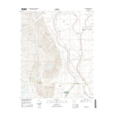
2014 Map of Wittsburg
USGS Topo · Published 2014About this map
The Saint Francis River winds through this landscape, creating a complex series of bends and bars including Wittsburg Island, Austelle Bar, and Filligrum Bend. The terrain transitions from the low-lying Saint Francis Floodway in the east to more elevated ground near Wittsburg and Levesque in the west. This area is defined by its water-dependent geography, where numerous sloughs and drains like Copeland Slough and Turkey Roost Drain crisscross the delta. Local history is anchored by sites such as Saint Marks Cem and Walters Cem, while the southern portion of the map highlights the recreational and ecological value of Lake Dunn and Lake Austell. The border between Cross Co and St. Francis Co runs through the lower third of the quadrangle, passing near the small settlement of Kinton.
Find a feature on this map
38 named features on this map. Tap any name to fly to it.
Don’t see what you’re looking for? This feature index may not catch every label — zoom into the map to look around manually.
Map Details
Editions of this 2014 Wittsburg Map
This is the sole edition of this map. No revisions or reprints were ever made.
Other maps of this area

1939 · Vanndale
USGS Topo · 1:62,500

1939 · Wynne
USGS Topo · 1:62,500

1940 · Princedale
USGS Topo · 1:62,500

1940 · Whitmore
USGS Topo · 1:62,500

1953 · Memphis
USGS Topo · 1:250,000

1956 · Memphis
USGS Topo · 1:250,000

1956 · Whitmore
USGS Topo · 1:62,500

1956 · Princedale
USGS Topo · 1:62,500

1958 · Wynne
USGS Topo · 1:62,500

1958 · Vanndale
USGS Topo · 1:62,500