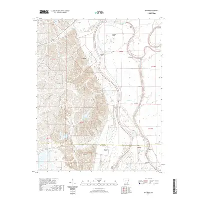
2020 Map of Wittsburg
USGS Topo · Published 2020About this map
Wittsburg and the surrounding Arkansas bottomlands are defined by the winding course of the Saint Francis River system and its complex flood control structures. The topography here is split between the elevated ridges of Village Creek State Park to the west and the broad alluvial plain of the Saint Francis Floodway to the east. This landscape reflects a history of managing the powerful Mississippi Delta waters, evidenced by the numerous bends and bars like Johnson Bend and Austelle Bar. Within the park, substantial water bodies such as Lake Dunn and Lake Austell are prominent features, while the lowland areas are dotted with smaller remnants like Bushy Lake and Big Bear Lake. Small settlements like Levesque and Kinton provide anchors for local history, alongside quiet landmarks such as Saint Marks Cem and Walters Cem, which speak to the area's rural genealogy.
Find a feature on this map
80 named features on this map. Tap any name to fly to it.
Don’t see what you’re looking for? This feature index may not catch every label — zoom into the map to look around manually.
Map Details
Editions of this 2020 Wittsburg Map
This is the sole edition of this map. No revisions or reprints were ever made.
Other maps of this area

1939 · Vanndale
USGS Topo · 1:62,500

1939 · Wynne
USGS Topo · 1:62,500

1940 · Princedale
USGS Topo · 1:62,500

1940 · Whitmore
USGS Topo · 1:62,500

1953 · Memphis
USGS Topo · 1:250,000

1956 · Memphis
USGS Topo · 1:250,000

1956 · Whitmore
USGS Topo · 1:62,500

1956 · Princedale
USGS Topo · 1:62,500

1958 · Wynne
USGS Topo · 1:62,500

1958 · Vanndale
USGS Topo · 1:62,500