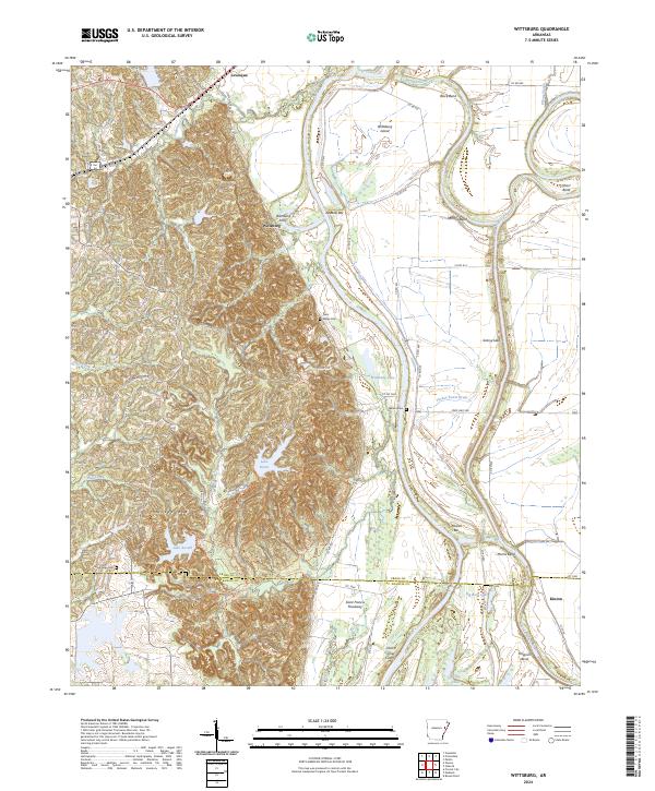
2024 Map of Wittsburg
USGS Topo · Published 2024About this map
Crowleys Ridge dominates the western half of this landscape, its elevated, dissected terrain rising sharply above the flat alluvial plains of the Saint Francis River valley. This geological divide defines the settlement patterns of the region, with the historic community of Wittsburg positioned at the critical junction where the ridge meets the river. The presence of the Wittsburg Ferry and numerous river features like Austelle Bar and Johnson Bend speak to the area's deep-rooted reliance on water-borne transit and commerce. On the ridge itself, Lake Dunn and Lake Austell are tucked within the narrow valleys, providing a contrast to the wide Saint Francis Floodway to the east. Genealogists can locate family landmarks such as Saint Marks Cem and Walters Cem, while the Old Cattle Trl near the Cross Co St Francis Co line offers a look at earlier agricultural movement through the bottomlands.
Find a feature on this map
77 named features on this map. Tap any name to fly to it.
Don’t see what you’re looking for? This feature index may not catch every label — zoom into the map to look around manually.
Map Details
Editions of this 2024 Wittsburg Map
This is the sole edition of this map. No revisions or reprints were ever made.
Other maps of this area

1939 · Vanndale
USGS Topo · 1:62,500

1939 · Wynne
USGS Topo · 1:62,500

1940 · Princedale
USGS Topo · 1:62,500

1940 · Whitmore
USGS Topo · 1:62,500

1953 · Memphis
USGS Topo · 1:250,000

1956 · Memphis
USGS Topo · 1:250,000

1956 · Whitmore
USGS Topo · 1:62,500

1956 · Princedale
USGS Topo · 1:62,500

1958 · Wynne
USGS Topo · 1:62,500

1958 · Vanndale
USGS Topo · 1:62,500