
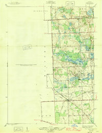
1945 Map of Wixom
USGS Topo · Published 1945About this map
Wixom serves as a central hub in this mid-century portrait of Oakland County, where the Pere Marquette railway intersects with local thoroughfares like Grand River Ave and Fourteen Mile Rd. The landscape is defined by its complex hydrology, with the Huron River feeding into Proud Lake and Commerce Lake. This era shows a transition from a rural agricultural patchwork to a recreational and residential corridor, evidenced by the presence of the Loon Lake Golf and Country Club alongside established landmarks like Stephens Sch and Wixom Cem. Drainage systems such as the Sibley Drain and Paton Drain reveal the intensive land management required to develop this lake-dotted terrain. Small clusters of development are visible at the road junctions, while the interior remains dominated by glacial kettles including Cranberry Lake and Jackway Lake.
Find a feature on this map
51 named features on this map. Tap any name to fly to it.
Don’t see what you’re looking for? This feature index may not catch every label — zoom into the map to look around manually.
Map Details
Editions of this 1945 Wixom Map
2 editions found
Other maps of this area

1902 · South Lyon
USGS Topo · 1:62,500

1904 · Ann Arbor
USGS Topo · 1:125,000

1905 · Wayne
USGS Topo · 1:62,500

1906 · South Lyon
USGS Topo · 1:62,500

1907 · Pontiac
USGS Topo · 1:62,500

1908 · Ann Arbor
USGS Topo · 1:125,000

1909 · Milford
USGS Topo · 1:62,500

1912 · Wayne
USGS Topo · 1:62,500

1936 · Wixom
USGS Topo · 1:31,680

1936 · Highland
USGS Topo · 1:31,680
Featured Places
- Novi, MI
- Commerce Charter Township, MI
- White Lake Charter Township, MI
- Lyon Charter Township, MI
- Highland Charter Township, MI