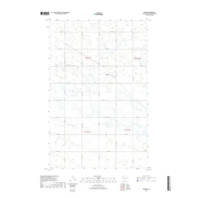
2017 Map of Woburn
USGS Topo · Published 2017About this map
Woburn sits within the high plains of Burke County, a landscape defined by its grid of rural roads and scattered wetlands. The agricultural character of the region is evident in the systematic layout of routes such as 81st Ave NW and 99th St NW, which facilitate movement between the sprawling farms of the northern prairie. Water is a defining presence here, with the prairie pothole geography represented by numerous small lakes and the winding courses of Stony Creek and the E Br Short Creek.
Find a feature on this map
25 named features on this map. Tap any name to fly to it.
Don’t see what you’re looking for? This feature index may not catch every label — zoom into the map to look around manually.
Map Details
Editions of this 2017 Woburn Map
This is the sole edition of this map. No revisions or reprints were ever made.
Other maps of this area

1947 · Flaxton
USGS Topo · 1:24,000

1948 · Flaxton
USGS Topo · 1:24,000

1948 · Coteau
USGS Topo · 1:24,000

1948 · Woburn
USGS Topo · 1:24,000

1948 · Vanville NE
USGS Topo · 1:24,000

1949 · Rennie Lake
USGS Topo · 1:24,000

1949 · Portal
USGS Topo · 1:24,000
1949 · Northgate
USGS Topo · 1:24,000

1950 · Vanville NE
USGS Topo · 1:24,000

1950 · Flaxton
USGS Topo · 1:62,500