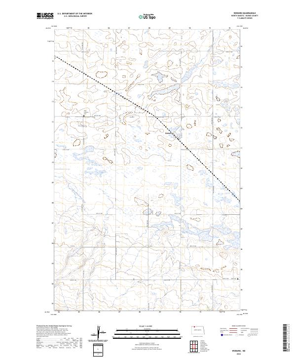
2024 Map of Woburn
USGS Topo · Published 2024About this map
Woburn stands as the primary namesake settlement in this corner of Burke County, situated in a landscape defined by prairie wetlands and small watercourses like Stony Creek and the East Branch Short Creek. The area's spiritual and family history is anchored by local landmarks such as Dale Lutheran Cem and Zion Cem, which mark the presence of early communities in these rural townships. Significant land use is dedicated to conservation, notably the Burke County Waterfowl Production Area, which preserves the native pothole topography that attracts migratory birds. A grid of county roads, including Co Rd 4 and Co Rd 13, structures the agricultural layout of the region, connecting remote farmsteads and rural sections across the North Dakota plains.
Find a feature on this map
26 named features on this map. Tap any name to fly to it.
Don’t see what you’re looking for? This feature index may not catch every label — zoom into the map to look around manually.
Map Details
Editions of this 2024 Woburn Map
This is the sole edition of this map. No revisions or reprints were ever made.
Other maps of this area

1947 · Flaxton
USGS Topo · 1:24,000

1948 · Flaxton
USGS Topo · 1:24,000

1948 · Coteau
USGS Topo · 1:24,000

1948 · Woburn
USGS Topo · 1:24,000

1948 · Vanville NE
USGS Topo · 1:24,000

1949 · Rennie Lake
USGS Topo · 1:24,000

1949 · Portal
USGS Topo · 1:24,000
1949 · Northgate
USGS Topo · 1:24,000

1950 · Vanville NE
USGS Topo · 1:24,000

1950 · Flaxton
USGS Topo · 1:62,500