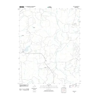
2010 Map of Wolco
USGS Topo · Published 2010About this map
Wolco serves as the central settlement in this Osage County landscape, situated at a junction of rural routes near the southern edge of the quadrangle. The terrain is defined by a dense network of drainage systems, including the southward-flowing Candy Creek and Tucker Creek, which eventually meet with Bird Creek. Several numbered dams, such as Waxhoma Lake Dam and various Oknoname structures, indicate a landscape managed for water storage and local ranching needs. The presence of Old State Hwy 11 and various county roads like Co Rd 2300 provides a clear view of the transportation network connecting the small community to the surrounding hills and creek valleys. This survey illustrates the transition from traditional state highway routes to the modern county road system in a region characterized by its numerous small tributaries like Dog Thresher Creek and East Chateau Creek.
Find a feature on this map
30 named features on this map. Tap any name to fly to it.
Don’t see what you’re looking for? This feature index may not catch every label — zoom into the map to look around manually.
Map Details
Editions of this 2010 Wolco Map
This is the sole edition of this map. No revisions or reprints were ever made.
Other maps of this area

1901 · Claremore
USGS Topo · 1:125,000

1901 · Nowata
USGS Topo · 1:125,000

1906 · Nelagoney
USGS Topo · 1:24,000

1909 · Pawhuska
USGS Topo · 1:125,000

1910 · Pawhuska
USGS Topo · 1:125,000

1912 · Hominy
USGS Topo · 1:125,000

1914 · Nowata
USGS Topo · 1:125,000

1914 · Claremore
USGS Topo · 1:125,000

1915 · Hominy
USGS Topo · 1:125,000

1916 · Claremore
USGS Topo · 1:125,000