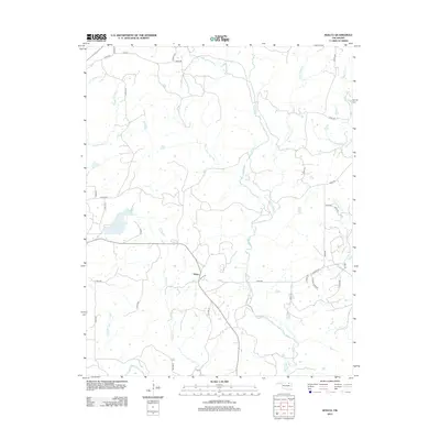
2013 Map of Wolco
USGS Topo · Published 2013About this map
Wolco sits at the heart of this Osage County landscape, centered at the junction of Wolco Rd and Old Hwy 11. The terrain is defined by an intricate network of waterways draining toward the south and east, notably Candy Cr and Little Candy Cr, which carve through the prairie. To the west, Waxhoma Lake provides a significant reservoir fed by the surrounding hills.
Find a feature on this map
39 named features on this map. Tap any name to fly to it.
Don’t see what you’re looking for? This feature index may not catch every label — zoom into the map to look around manually.
Map Details
Editions of this 2013 Wolco Map
This is the sole edition of this map. No revisions or reprints were ever made.
Other maps of this area

1901 · Claremore
USGS Topo · 1:125,000

1901 · Nowata
USGS Topo · 1:125,000

1906 · Nelagoney
USGS Topo · 1:24,000

1909 · Pawhuska
USGS Topo · 1:125,000

1910 · Pawhuska
USGS Topo · 1:125,000

1912 · Hominy
USGS Topo · 1:125,000

1914 · Nowata
USGS Topo · 1:125,000

1914 · Claremore
USGS Topo · 1:125,000

1915 · Hominy
USGS Topo · 1:125,000

1916 · Claremore
USGS Topo · 1:125,000