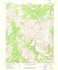
1972 Map of Wolco
USGS Topo · Published 1973About this map
Wolco sits at the heart of this survey, surrounded by the distinctive topography of the Big Heart region. The landscape is defined by its deep involvement in the petroleum industry, evidenced by the dense concentration of Oil Wells, Gas Wells, and various Drill Holes scattered across the township lines. Along the western edge, Lake Waxhoma serves as a primary water feature, complete with a recorded Spillway Elev 748 and an adjacent Picnic Area for recreation.
Find a feature on this map
21 named features on this map. Tap any name to fly to it.
Don’t see what you’re looking for? This feature index may not catch every label — zoom into the map to look around manually.
Map Details
Editions of this 1972 Wolco Map
This is the sole edition of this map. No revisions or reprints were ever made.
Other maps of this area

1901 · Claremore
USGS Topo · 1:125,000

1901 · Nowata
USGS Topo · 1:125,000

1906 · Nelagoney
USGS Topo · 1:24,000

1909 · Pawhuska
USGS Topo · 1:125,000

1910 · Pawhuska
USGS Topo · 1:125,000

1912 · Hominy
USGS Topo · 1:125,000

1914 · Nowata
USGS Topo · 1:125,000

1914 · Claremore
USGS Topo · 1:125,000

1915 · Hominy
USGS Topo · 1:125,000

1916 · Claremore
USGS Topo · 1:125,000