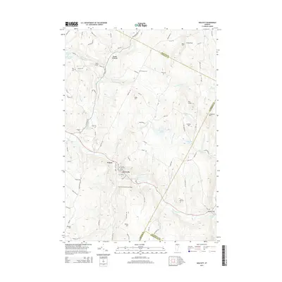
2015 Map of Wolcott
USGS Topo · Published 2015About this map
The Lamoille River carves through the center of this terrain, anchoring the primary settlements of Wolcott and Pottersville. The river's influence on local infrastructure is evident at the Lamoille River Reservoir and the Fisher Covered Railroad Bridge, a notable landmark along the rail corridor. The surrounding landscape is defined by significant elevations such as Jeudevine Mtn and Scribner Hill, which hem in numerous water bodies including Wolcott Pond and Wapanacki Lake. For genealogists, the map is particularly rich in family-named landmarks and resting places, from the Fairmont Upper Cem and Fairmont Lower Cem near the river to the more isolated Jacob Paine Cem. Small pockets of development like North Wolcott and Jackson Bridge illustrate the distribution of late 20th-century rural communities in this corner of Vermont.
Find a feature on this map
101 named features on this map. Tap any name to fly to it.
Don’t see what you’re looking for? This feature index may not catch every label — zoom into the map to look around manually.
Map Details
Editions of this 2015 Wolcott Map
This is the sole edition of this map. No revisions or reprints were ever made.
Other maps of this area

1919 · Montpelier
USGS Topo · 1:62,500

1921 · Montpelier
USGS Topo · 1:62,500

1927 · Hyde Park
USGS Topo · 1:48,000

1928 · Hardwick
USGS Topo · 1:62,500

1930 · Hyde Park
USGS Topo · 1:62,500

1934 · Hardwick
USGS Topo · 1:48,000

1938 · Hardwick
USGS Topo · 1:62,500

1939 · Plainfield
USGS Topo · 1:48,000

1940 · Plainfield
USGS Topo · 1:62,500

1943 · Plainfield
USGS Topo · 1:62,500