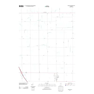
2013 Map of Wolcott
USGS Topo · Published 2013About this map
Wolcott sits at the intersection of a precise agricultural grid and a complex drainage network in this White County survey. The landscape is defined by its extensive system of man-made waterways, including Bice Ditch, Frank May Ditch, and Spurgeon Ditch, which manage the water levels of these productive Indiana plains. These ditches often bear family names, suggesting the lineage of land improvement and drainage districts that transformed the terrain for farming.
Find a feature on this map
56 named features on this map. Tap any name to fly to it.
Don’t see what you’re looking for? This feature index may not catch every label — zoom into the map to look around manually.
Map Details
Editions of this 2013 Wolcott Map
This is the sole edition of this map. No revisions or reprints were ever made.
Other maps of this area

1953 · Danville
USGS Topo · 1:250,000

1955 · Danville
USGS Topo · 1:250,000

1956 · Danville
USGS Topo · 1:250,000

1962 · Mount Gilboa
USGS Topo · 1:24,000

1962 · Templeton NE
USGS Topo · 1:24,000

1962 · Brookston NW
USGS Topo · 1:24,000

1962 · Monon
USGS Topo · 1:24,000
1962 · Francesville
USGS Topo · 1:24,000
1962 · Mc Coysburg
USGS Topo · 1:24,000
1962 · Rensselaer
USGS Topo · 1:24,000