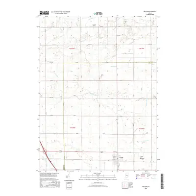
2016 Map of Wolcott
USGS Topo · Published 2016About this map
The town of Wolcott sits at the southern edge of this West Central Indiana landscape, where the survey highlights a meticulously managed agricultural environment. A dense network of drainage channels, including Keefe Ditch, Spurgeon Ditch, and McKillip Ditch, underscores the area's transition from wetlands to productive farmland. For researchers of local history, several small burial sites are scattered across the township, such as Mcllroy Cem in the north and Dobbins Cem near the center, offering clues to early rural settlement patterns.
Find a feature on this map
55 named features on this map. Tap any name to fly to it.
Don’t see what you’re looking for? This feature index may not catch every label — zoom into the map to look around manually.
Map Details
Editions of this 2016 Wolcott Map
This is the sole edition of this map. No revisions or reprints were ever made.
Other maps of this area

1953 · Danville
USGS Topo · 1:250,000

1955 · Danville
USGS Topo · 1:250,000

1956 · Danville
USGS Topo · 1:250,000

1962 · Mount Gilboa
USGS Topo · 1:24,000

1962 · Templeton NE
USGS Topo · 1:24,000

1962 · Brookston NW
USGS Topo · 1:24,000

1962 · Monon
USGS Topo · 1:24,000
1962 · Francesville
USGS Topo · 1:24,000
1962 · Mc Coysburg
USGS Topo · 1:24,000
1962 · Rensselaer
USGS Topo · 1:24,000