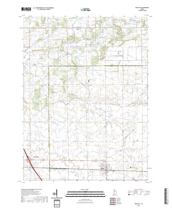
2022 Map of Wolcott
USGS Topo · Published 2022About this map
Wolcott and Remington anchor the southern reaches of this landscape, situated along the border of Jasper and White Counties. This modern survey reveals a highly organized agricultural grid defined by a complex network of drainage systems essential to Indiana's prairie farming. Named waterways like Winters Ditch, McKillip Ditch, and Spurgeon Ditch snake through the rectangular plots, following a centuries-old pattern of water management.
Find a feature on this map
50 named features on this map. Tap any name to fly to it.
Don’t see what you’re looking for? This feature index may not catch every label — zoom into the map to look around manually.
Map Details
Editions of this 2022 Wolcott Map
This is the sole edition of this map. No revisions or reprints were ever made.
Other maps of this area

1953 · Danville
USGS Topo · 1:250,000

1955 · Danville
USGS Topo · 1:250,000

1956 · Danville
USGS Topo · 1:250,000

1962 · Mount Gilboa
USGS Topo · 1:24,000

1962 · Templeton NE
USGS Topo · 1:24,000

1962 · Brookston NW
USGS Topo · 1:24,000

1962 · Monon
USGS Topo · 1:24,000
1962 · Francesville
USGS Topo · 1:24,000
1962 · Mc Coysburg
USGS Topo · 1:24,000
1962 · Rensselaer
USGS Topo · 1:24,000