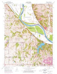
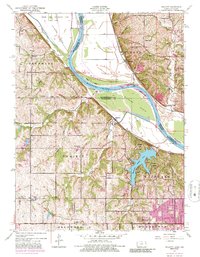
1948 Map of Wolcott
USGS Topo · Published 1976About this map
Wyandotte County Lake dominates the central landscape of this Wyandotte County survey, surrounded by the green expanses of Wyandotte County Park. The Missouri River forms a wide, sweeping boundary through the north, defining large alluvial features like Diamond Island and Stigers Island. This region reflects a complex mix of agricultural and institutional land use during the mid-century, evidenced by the Kansas State Penitentiary Farm in the northwest and various small rural settlements like Wolcott, Piper, and Waldron.
Find a feature on this map
50 named features on this map. Tap any name to fly to it.
Don’t see what you’re looking for? This feature index may not catch every label — zoom into the map to look around manually.
Map Details
Editions of this 1948 Wolcott Map
5 editions found
Other maps of this area

1890 · Kansas City
USGS Topo · 1:125,000

1894 · Kansas City
USGS Topo · 1:125,000

1910 · Leavenworth
USGS Topo · 1:62,500

1914 · Smithville
USGS Topo · 1:62,500

1934 · Bonner Springs
USGS Topo · 1:48,000

1934 · Shawnee
USGS Topo · 1:24,000

1934 · Edwardsville
USGS Topo · 1:24,000

1934 · Wolcott
USGS Topo · 1:24,000

1940 · Bonner Springs
USGS Topo · 1:62,500
1943 · Shawnee
USGS Topo · 1:31,680