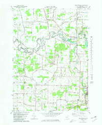
1980 Map of Wolcottsville
USGS Topo · Published 1980About this map
Tonawanda Creek winds through the heart of this Western New York landscape, marking the natural boundary between Niagara and Erie counties. In the early 1980s, this area retained its agricultural and rural character, anchored by the crossroad settlements of Wolcottsville and Akron. The drainage patterns of Black Creek, Murder Creek, and Mud Creek define the low-lying terrain, while the Conrail rail corridor and a network of named country lanes like Kelkenberg Road and Rapids Road facilitate transport across the plains.
Find a feature on this map
56 named features on this map. Tap any name to fly to it.
Don’t see what you’re looking for? This feature index may not catch every label — zoom into the map to look around manually.
Map Details
Editions of this 1980 Wolcottsville Map
2 editions found
Other maps of this area

1897 · Medina
USGS Topo · 1:62,500

1897 · Lockport
USGS Topo · 1:62,500

1899 · Niagara
USGS Topo · 1:125,000

1902 · Lockport
USGS Topo · 1:62,500

1905 · Attica
USGS Topo · 1:62,500

1905 · Depew
USGS Topo · 1:62,500

1905 · Lockport
USGS Topo · 1:62,500

1948 · Depew
USGS Topo · 1:62,500

1948 · Lockport
USGS Topo · 1:62,500

1949 · Attica
USGS Topo · 1:62,500