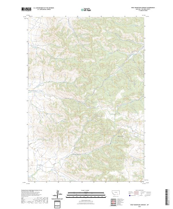
2024 Map of Wolf Mountain Lookout
USGS Topo · Published 2024About this map
The Wolf Mountains dominate this high-country landscape in Big Horn County, characterized by a complex network of seasonal drainages and sharp ridges. The terrain is defined by dramatic elevation changes, notably around Shortys Hill and the deep incision of Cook Stove Canyon to the south. This area is shaped by a remote road network that follows the natural contours of the land, including Grey Blanket Rd and Corral Cr Rd, which serve the expansive ranchlands and wilderness sectors.
Find a feature on this map
19 named features on this map. Tap any name to fly to it.
Don’t see what you’re looking for? This feature index may not catch every label — zoom into the map to look around manually.
Map Details
Editions of this 2024 Wolf Mountain Lookout Map
This is the sole edition of this map. No revisions or reprints were ever made.
Other maps of this area

1894 · Rosebud
USGS Topo · 1:125,000

1901 · Rosebud
USGS Topo · 1:125,000

1954 · Hardin
USGS Topo · 1:250,000

1957 · Hardin
USGS Topo · 1:250,000

1958 · Hardin
USGS Topo · 1:250,000

1967 · Lodge Grass NE
USGS Topo · 1:24,000

1967 · Kid Creek
USGS Topo · 1:24,000

1967 · Wolf Mountain Lookout
USGS Topo · 1:24,000

1967 · Bar V Ranch NE
USGS Topo · 1:24,000
1967 · Wyola NE
USGS Topo · 1:24,000