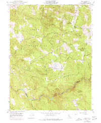
1949 Map of Wolf
USGS Topo · Published 1977About this map
The boundary between Nevada and Placer counties follows the winding course of the Bear River as it cuts through the foothills of the Sierra Nevada. In the years following World War II, the landscape is defined by its transition from traditional resource extraction to military utility, notably evidenced by the expansive eastern edge of Beale Air Force Base. Gold-era remnants persist through infrastructure like the Pine Hill Mine and a network of water management features including Ditch, Flume, and a Siphon that move water across the ridgelines near Hog Hill and Cole Hill. Small community hubs like Banner Grange and the settlement of Wolf provide a glimpse into the local social fabric of the late 1940s, while the Cranston Ranch and a private Landing Strip reflect the private landholdings that occupy the valleys between landmarks such as Bald Mtn and Sugar Loaf Mtn.
Find a feature on this map
33 named features on this map. Tap any name to fly to it.
Don’t see what you’re looking for? This feature index may not catch every label — zoom into the map to look around manually.
Map Details
Editions of this 1949 Wolf Map
3 editions found
Other maps of this area

1888 · Smartsville
USGS Topo · 1:125,000

1891 · Sacramento
USGS Topo · 1:125,000

1891 · Smartsville
USGS Topo · 1:125,000

1892 · Sacramento
USGS Topo · 1:125,000

1892 · Smartsville
USGS Topo · 1:125,000

1893 · Sacramento
USGS Topo · 1:125,000

1894 · Smartsville
USGS Topo · 1:125,000

1895 · Smartsville
USGS Topo · 1:125,000

1910 · Lincoln
USGS Topo · 1:31,680

1915 · Spenceville
USGS Topo · 1:31,680