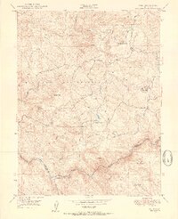
1949 Map of Wolf
USGS Topo · Published 1954About this map
The Camp Beale Military Reservation dominates the western half of this 1949 terrain study, reflecting the significant federal footprint in the foothills of Nevada County and Placer County following World War II. This landscape is a complex network of ridges and water-conveyance systems, where the Camp Far West Ditch and various siphons and flumes trace the contours to manage water for downstream use. The southern boundary is defined by the winding course of the Bear River, which separates the two counties near the Garden Bar settlement. Local civic and industrial life is anchored by the Wolf PO and the Banner Grange, while mining history is represented by the Pine Hill Mine located near the eastern margin. Family-named landmarks such as Cranston Ranch and Lucas Hill provide specific points of interest for genealogists tracing the rural development of the California Gold Country during this era.
Find a feature on this map
35 named features on this map. Tap any name to fly to it.
Don’t see what you’re looking for? This feature index may not catch every label — zoom into the map to look around manually.
Map Details
Editions of this 1949 Wolf Map
3 editions found
Other maps of this area

1888 · Smartsville
USGS Topo · 1:125,000

1891 · Sacramento
USGS Topo · 1:125,000

1891 · Smartsville
USGS Topo · 1:125,000

1892 · Sacramento
USGS Topo · 1:125,000

1892 · Smartsville
USGS Topo · 1:125,000

1893 · Sacramento
USGS Topo · 1:125,000

1894 · Smartsville
USGS Topo · 1:125,000

1895 · Smartsville
USGS Topo · 1:125,000

1910 · Lincoln
USGS Topo · 1:31,680

1915 · Spenceville
USGS Topo · 1:31,680