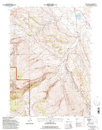
1991 Map of Wolf Point
USGS Topo · Published 1997About this map
The Little Popo Agie River carves through this high-altitude landscape of central Wyoming, where established agricultural and ranching operations like the Whitehead Ranch and Wilkinson Ranch occupy the more accessible drainages. Evidence of a rural community structure is visible through a network of local institutions, including the Upper Willow Creek Sch, Lower Willow Creek Sch, and Madison Creek Sch, all situated to serve the dispersed population of this mountain-fringe territory.
Find a feature on this map
48 named features on this map. Tap any name to fly to it.
Don’t see what you’re looking for? This feature index may not catch every label — zoom into the map to look around manually.
Map Details
Editions of this 1991 Wolf Point Map
This is the sole edition of this map. No revisions or reprints were ever made.
Other maps of this area

1952 · Lander SE
USGS Topo · 1:24,000

1952 · Lander
USGS Topo · 1:24,000

1953 · Gravel Spring
USGS Topo · 1:24,000

1953 · Fossil Hill
USGS Topo · 1:24,000

1953 · Louis Lake
USGS Topo · 1:24,000

1953 · Weiser Pass
USGS Topo · 1:24,000

1953 · Mount Arter SE
USGS Topo · 1:24,000

1954 · Wolf Point
USGS Topo · 1:24,000

1954 · Miners Delight
USGS Topo · 1:24,000

1955 · Lander
USGS Topo · 1:250,000