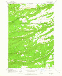
1962 Map of Wolf Run
USGS Topo · Published 1964About this map
Mt Hood Flat and the forested slopes of the Mt Hood National Forest define this landscape in north-central Oregon. The map documents a complex network of waterways, including Fivemile Creek, Eightmile Creek, and Fifteenmile Creek, which carve through the high terrain. Civil infrastructure is centered around the Wolf Run Community Hall and the Dufur City Reservoir, reflecting the rural community's management of water resources and social gathering spaces. Early transportation routes like the Skyline Road, Mail Road, and the arterial Dufur Mill Road trace the ridges and canyons, providing access to remote timberlands and high-altitude grazing. Recreation and forestry operations are evidenced by the presence of the Wolf Run Campground, Fifteenmile Campground, and a scattered Gravel Pit. The terrain is marked by distinctive local landmarks such as Pleasant Ridge and Hesslan Canyon, illustrating the varied topography east of the Cascades.
Find a feature on this map
31 named features on this map. Tap any name to fly to it.
Don’t see what you’re looking for? This feature index may not catch every label — zoom into the map to look around manually.
Map Details
Editions of this 1962 Wolf Run Map
2 editions found
Other maps of this area

1930 · Dufur
USGS Topo · 1:125,000

1934 · Dufur
USGS Topo · 1:125,000

1934 · The Dalles
USGS Topo · 1:125,000

1953 · The Dalles
USGS Topo · 1:250,000

1956 · The Dalles
USGS Topo · 1:250,000

1957 · The Dalles
USGS Topo · 1:250,000

1957 · The Dalles
USGS Topo · 1:62,500

1957 · White Salmon
USGS Topo · 1:62,500

1962 · Wolf Run
USGS Topo · 1:24,000

1962 · Postage Stamp Butte
USGS Topo · 1:24,000