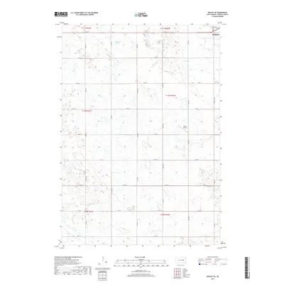
2017 Map of Wolsey SE
USGS Topo · Published 2017About this map
Huron anchors the northeastern corner of this Beadle County landscape, where the outskirts of the city meet the vast agricultural sections of central South Dakota. The terrain is defined by its subtle glacial depressions and prairie water systems, most notably Schwartz Slough and the winding course of Cain Cr in the south. The land is organized by an exacting grid of section-line roads, including Co Rd 15 and Co Rd 20, which reflect the late-period rural infrastructure of the region.
Find a feature on this map
31 named features on this map. Tap any name to fly to it.
Don’t see what you’re looking for? This feature index may not catch every label — zoom into the map to look around manually.
Map Details
Editions of this 2017 Wolsey SE Map
This is the sole edition of this map. No revisions or reprints were ever made.
Other maps of this area

1898 · Huron
USGS Topo · 1:125,000

1953 · Huron
USGS Topo · 1:250,000

1954 · Huron
USGS Topo · 1:250,000

1957 · Huron
USGS Topo · 1:24,000

1958 · Forestburg NW
USGS Topo · 1:24,000

1958 · Huron NW
USGS Topo · 1:24,000
1973 · Wolsey
USGS Topo · 1:24,000

1973 · Alpena
USGS Topo · 1:24,000
1973 · Broadland
USGS Topo · 1:24,000
1973 · Virgil
USGS Topo · 1:24,000