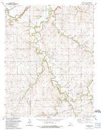
1989 Map of Wonsevu
USGS Topo · Published 1990About this map
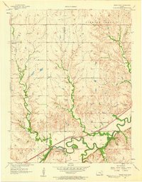
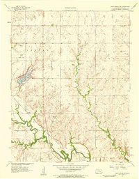
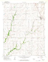
Wonsevu serves as the primary point of interest in this late-twentieth-century landscape of Chase County, where the topography is defined by the winding course of the Cottonwood River. This area represents the intersection of several notable drainage systems, with Coon Creek and Martin Creek contributing to the local hydrology. The mapping, revised in the late 1980s, reflects a rural Kansas environment where the natural contours of the land dictate the layout of small settlements and transportation routes. The detailed recording of these water bodies highlights the ongoing importance of the river systems in shaping the development and land-use patterns of the region.
Find a feature on this map
4 named features on this map. Tap any name to fly to it.
Don’t see what you’re looking for? This feature index may not catch every label — zoom into the map to look around manually.
Map Details
Editions of this 1989 Wonsevu Map
This is the sole edition of this map. No revisions or reprints were ever made.
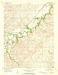
Other maps of this area

1898 · Cottonwood Falls
USGS Topo · 1:125,000

1955 · Hutchinson
USGS Topo · 1:250,000
1957 · Elmdale
USGS Topo · 1:24,000
1957 · Florence
USGS Topo · 1:24,000
1957 · Wonsevu
USGS Topo · 1:24,000
1957 · Cedar Point
USGS Topo · 1:24,000
1957 · Lincolnville SW
USGS Topo · 1:24,000

1959 · Hutchinson
USGS Topo · 1:250,000

1962 · Florence SE
USGS Topo · 1:24,000
1962 · Burns
USGS Topo · 1:24,000