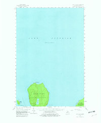
1958 Map of Wood Island
USGS Topo · Published 1982About this map
Grand Island dominates this mid-century coastal survey, situated within the cold reaches of Lake Superior off the coast of Alger County. The map shows the island's interior geography in detail, centered on Echo Lake and its outlet, Echo Lake Cr, which drains into Trout Bay. To the north, a Lighthouse sits at North Point, serving as a critical navigational aid for the maritime traffic of the Great Lakes.
Find a feature on this map
12 named features on this map. Tap any name to fly to it.
Don’t see what you’re looking for? This feature index may not catch every label — zoom into the map to look around manually.
Map Details
Editions of this 1958 Wood Island Map
3 editions found
Other maps of this area

1958 · Munising
USGS Topo · 1:62,500

1958 · Au Train
USGS Topo · 1:62,500

1958 · Wood Island
USGS Topo · 1:62,500

1958 · Shingleton
USGS Topo · 1:62,500

1958 · Grand Portal Point
USGS Topo · 1:62,500

1958 · Marquette
USGS Topo · 1:250,000

1960 · Marquette
USGS Topo · 1:250,000

1961 · Marquette
USGS Topo · 1:250,000

1968 · Marquette
USGS Topo · 1:250,000

1983 · Munising
USGS Topo · 1:100,000