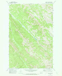
1970 Map of Wood Lake
USGS Topo · Published 1973About this map
The Lewis and Clark National Forest encompasses this high-elevation landscape, where deep drainages like Wood Creek and Ford Creek carve through the mountain front. This 1970 field-checked survey highlights a remote recreational hub at the Benchmark Airfield, serving as a gateway for backcountry access. Nearby, the Fly-in Campground and Wood Lake Campground suggest a mid-century period of developed forest service infrastructure. The map tracks a transition from the level expanse of the Fairview Plateau down to the steep, narrow corridors of the Hogback. Notable peaks such as Cyanide Mtn and Crown Mountain overlook a network of primitive routes including the Straight Creek Trail and Petty Crown Trail, which provided essential access for packing into Alpine Lake and the Elbow Pass during the early 1970s.
Find a feature on this map
39 named features on this map. Tap any name to fly to it.
Don’t see what you’re looking for? This feature index may not catch every label — zoom into the map to look around manually.
Map Details
Editions of this 1970 Wood Lake Map
This is the sole edition of this map. No revisions or reprints were ever made.
Other maps of this area

1903 · Saypo
USGS Topo · 1:125,000

1903 · Coopers Lake
USGS Topo · 1:125,000

1955 · Choteau
USGS Topo · 1:250,000

1957 · Choteau
USGS Topo · 1:250,000

1958 · Choteau
USGS Topo · 1:250,000

1958 · Sawtooth Ridge
USGS Topo · 1:24,000

1958 · Pretty Prairie
USGS Topo · 1:24,000

1958 · Patricks Basin
USGS Topo · 1:24,000

1962 · Choteau
USGS Topo · 1:250,000
1970 · Scapegoat Mountain
USGS Topo · 1:24,000