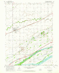
1962 Map of Wood River
USGS Topo · Published 1964About this map
The town of Wood River serves as the focal point of this Nebraska landscape, situated at the intersection of the Union Pacific railroad and Highway 30. This early 1960s study captures a complex riverine environment where the Platte River diverges into the North Channel, Middle Channel, and South Channel. These waterways define the large expanse of Shoemaker Island, a low-lying area that illustrates the braided nature of the Platte River system before modern channelization altered its historical course. Rural life is well-documented through the placement of several localized educational centers, including School No 25, School No 63, and Woodland Sch. The infrastructure of the era is evident in the Sewage Disposal Ponds near the town center and a Gravel Pit along the river, while the Wood River Cem stands as a permanent fixture for genealogical researchers tracing the early families of Hall County.
Find a feature on this map
20 named features on this map. Tap any name to fly to it.
Don’t see what you’re looking for? This feature index may not catch every label — zoom into the map to look around manually.
Map Details
Editions of this 1962 Wood River Map
3 editions found
Other maps of this area

1892 · Grand Island
USGS Topo · 1:62,500

1894 · Kenesaw
USGS Topo · 1:62,500

1895 · Grand Island
USGS Topo · 1:62,500

1895 · Wood River
USGS Topo · 1:62,500

1896 · Wood River
USGS Topo · 1:125,000

1898 · Grand Island
USGS Topo · 1:125,000

1955 · Grand Island
USGS Topo · 1:250,000

1957 · Grand Island
USGS Topo · 1:250,000

1958 · Grand Island
USGS Topo · 1:250,000

1962 · Denman
USGS Topo · 1:24,000