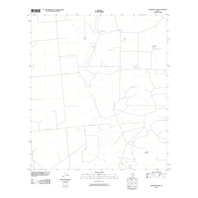
2010 Map of Woodard Lake
USGS Topo · Published 2010About this map
Woodard Lake and the surrounding ranchlands of Zavala County define this arid landscape during the early 21st century. The map reveals an intricate network of water management features essential for livestock and agriculture in South Texas, including several named stock ponds such as Big Tank, Rock Hill Tank, and Prairie Tank. Near the eastern boundary, the Kieschnick Ranch represents the local legacy of large-scale landholdings that have shaped the region's economy for generations.
Find a feature on this map
16 named features on this map. Tap any name to fly to it.
Don’t see what you’re looking for? This feature index may not catch every label — zoom into the map to look around manually.
Map Details
Editions of this 2010 Woodard Lake Map
This is the sole edition of this map. No revisions or reprints were ever made.
Other maps of this area

1939 · Carrizo Springs
USGS Topo · 1:62,500

1939 · Big Wells
USGS Topo · 1:62,500

1939 · La Pryor
USGS Topo · 1:62,500

1953 · Crystal City
USGS Topo · 1:250,000

1955 · Crystal City
USGS Topo · 1:250,000

1957 · Batesville
USGS Topo · 1:62,500

1961 · Crystal City
USGS Topo · 1:250,000

1968 · Crystal City
USGS Topo · 1:250,000
1972 · Big Wells
USGS Topo · 1:24,000
1972 · Batesville SW
USGS Topo · 1:24,000