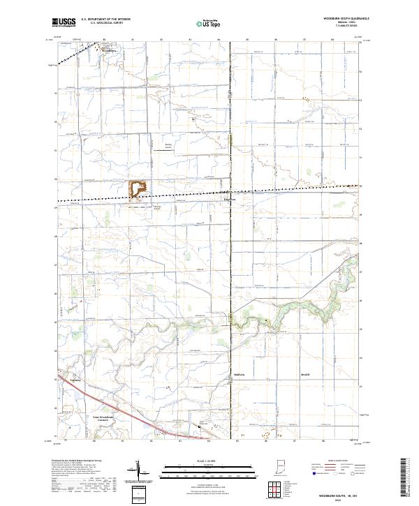
2022 Map of Woodburn South
USGS Topo · Published 2022About this map
Woodburn sits at the northern edge of this agricultural landscape, where the flatlands of the Indiana-Ohio border are defined by a complex network of man-made drainage systems. The persistence of the rectangular survey system is evident in the dead-straight roads like Edgerton Rd and Paulding Rd, which serve scattered farming hamlets including Edgerton, Baldwin, and Townley. The terrain is shaped by the Maumee lake plain, requiring the extensive ditching seen in labels like Knoblaugh Ditch and Anspaugh Ditch to manage the heavy soils for cultivation.
Find a feature on this map
102 named features on this map. Tap any name to fly to it.
Don’t see what you’re looking for? This feature index may not catch every label — zoom into the map to look around manually.
Map Details
Editions of this 2022 Woodburn South Map
This is the sole edition of this map. No revisions or reprints were ever made.
Other maps of this area

1914 · Van Wert
USGS Topo · 1:62,500

1914 · Paulding
USGS Topo · 1:62,500

1944 · Van Wert
USGS Topo · 1:62,500

1944 · Paulding
USGS Topo · 1:62,500

1953 · Fort Wayne
USGS Topo · 1:250,000

1953 · Muncie
USGS Topo · 1:250,000

1956 · Muncie
USGS Topo · 1:250,000

1956 · Fort Wayne
USGS Topo · 1:250,000

1957 · Maples
USGS Topo · 1:24,000

1958 · Grabill
USGS Topo · 1:24,000